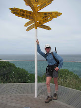
It was great to be at the official opening of Te Araroa with Hazel on December 3rd and from it get a better appreciation of the major undertaking that has brought TA to this point. The Island Bay setting was superb and the weather was so kind. Afterwards we followed TA back into the city, as ever impressed by how strenuous Wellington city walks can be !
Soon after Christmas I will be on the trail again, first from St Arnaud south to the St James Walkway and then a big loop back to St Arnaud with a party from the Auckland Tramping Club. Then reversing my normal direction, two of us will be going south to north up the Richmond Ranges, so that I can then complete the TA route up to Pelorus Bridge, where I arrived from the north back in April. All going well I will then travel back down to the top of the St James Walkway and follow that until where my first trip left off, and then continue, ever on.
Saturday, December 17, 2011

Monday, April 25, 2011
Queen Charlotte Track to Pelorus Bridge
Sunday 24th April 38.5 km 8 hours, including a good break in The Mussel Pot, Havelock, for lunch
Rained all night, and pleased that my tent coped remarkably well. Packed up in the rain, and then off on the last 30 minutes of the Queen Charlotte Track to Anakiwa. Water everywhere, and the rain continuing on through the day only too regularly. So now at the head of Queen Charlotte Sound, with a combination of walking tracks and roads to take me away west from the sound, and over to the head of an arm of Pelorus Sound.
As promised the side track up Mahakipawa Hill was steep, but fortunately not the bare clay surface going up as per the TA notes - if it had been, that would have meant a road diversion. But steep up, and then steep and more slippery down with Havelock being so close at the bottom, so a lot of care needed to stay on my feet - success !
Patchy views of the surrounding hills, and the Sounds looking quite brown from the runoff from all the rivers and creeks that were now in flood. After lunch along SH6 towards Canvastown, with time to watch the flooded rivers and creeks, and the many waterfalls on the side of the road. With the creeks flooded, at Daltons Bridge, rather than taking the new track from there to Pelorus Bridge (which has side creeks to cross) I stayed on the main road. As soon as I reached the Pelorus Bridge DOC sign a sandfly spotted me.
A change into dry clothes (yay!), a pie at the cafe, and time now to leave Te Araroa until next summer. Richmond Ranges ahead, which are serious tramping country - I will have to check out my options before continuing on.
Rained all night, and pleased that my tent coped remarkably well. Packed up in the rain, and then off on the last 30 minutes of the Queen Charlotte Track to Anakiwa. Water everywhere, and the rain continuing on through the day only too regularly. So now at the head of Queen Charlotte Sound, with a combination of walking tracks and roads to take me away west from the sound, and over to the head of an arm of Pelorus Sound.
As promised the side track up Mahakipawa Hill was steep, but fortunately not the bare clay surface going up as per the TA notes - if it had been, that would have meant a road diversion. But steep up, and then steep and more slippery down with Havelock being so close at the bottom, so a lot of care needed to stay on my feet - success !
Patchy views of the surrounding hills, and the Sounds looking quite brown from the runoff from all the rivers and creeks that were now in flood. After lunch along SH6 towards Canvastown, with time to watch the flooded rivers and creeks, and the many waterfalls on the side of the road. With the creeks flooded, at Daltons Bridge, rather than taking the new track from there to Pelorus Bridge (which has side creeks to cross) I stayed on the main road. As soon as I reached the Pelorus Bridge DOC sign a sandfly spotted me.
A change into dry clothes (yay!), a pie at the cafe, and time now to leave Te Araroa until next summer. Richmond Ranges ahead, which are serious tramping country - I will have to check out my options before continuing on.
Queen Charlotte Track Day 2
Saturday 23rd April 7.5 hrs 32.5 km
Bay Of Many Coves campsite to Umungata (Davies) Bay campsite. Now along the ridge between Queen Charlotte and Kerepuru Sounds, with views sometimes to one side, and sometimes to the other. Fortunately not following the exact contours of the ridge, so not a steep up and down track all the time - just some of the time when coming to the lower saddles between the two Sounds.
By late morning the occasional light drizzle had become occasional, and then more persistent rain. But not cold or windy, so relatively pleasant if you kept moving. Track becoming a bit more slippery in places, but staying on my feet all of today. Pitched tent in the rain, and it now really was quite continuous. Just about at the end of the track, but stopped here because this is the last DOC campsite.
Bay Of Many Coves campsite to Umungata (Davies) Bay campsite. Now along the ridge between Queen Charlotte and Kerepuru Sounds, with views sometimes to one side, and sometimes to the other. Fortunately not following the exact contours of the ridge, so not a steep up and down track all the time - just some of the time when coming to the lower saddles between the two Sounds.
By late morning the occasional light drizzle had become occasional, and then more persistent rain. But not cold or windy, so relatively pleasant if you kept moving. Track becoming a bit more slippery in places, but staying on my feet all of today. Pitched tent in the rain, and it now really was quite continuous. Just about at the end of the track, but stopped here because this is the last DOC campsite.
South Island - Queen Charlotte Track
Easter Friday 22nd April 36 km 7 hours
From Ship Cove to Bay of Many Coves campsite. A fine day with some cloud, but wet weather on the way, so making the most of it today.
Time for a quick look at the Cook memorial, then off up the hill away from Ship Cove. In and out of little valleys, past Resolution Bay then up to a saddle looking down into Endeavour Inlet. Where I caught up with the large group of mountain bikers who had passed me earlier. But then they were gone off down the hill.
A close encounter with the track, courtesy of a tree root, left a bit o damage, but nothing to hold me up too long. Down along the shore of Endeavour Inlet, on past the houses at the end, and then a lunch stop looking back to where I had been an hour or so earlier. And so the track winds on, into and out of Big Bay, and then the direct route up to Kerepuru Saddle (bypassing Camp Bay) Now views of Sounds on both sides of the track, notably from the 2 Eastwell lookouts - the second especially a superb high point up a steep side track.
And so on to the Bay of Many Coves campsite on the ridge looking down into Queen Charlotte Sound. A weka tried to souvenir one of my walking socks, but had the sense to understand that it was fairly undesirable, leaving it a short way off in the undergrowth.
From Ship Cove to Bay of Many Coves campsite. A fine day with some cloud, but wet weather on the way, so making the most of it today.
Time for a quick look at the Cook memorial, then off up the hill away from Ship Cove. In and out of little valleys, past Resolution Bay then up to a saddle looking down into Endeavour Inlet. Where I caught up with the large group of mountain bikers who had passed me earlier. But then they were gone off down the hill.
A close encounter with the track, courtesy of a tree root, left a bit o damage, but nothing to hold me up too long. Down along the shore of Endeavour Inlet, on past the houses at the end, and then a lunch stop looking back to where I had been an hour or so earlier. And so the track winds on, into and out of Big Bay, and then the direct route up to Kerepuru Saddle (bypassing Camp Bay) Now views of Sounds on both sides of the track, notably from the 2 Eastwell lookouts - the second especially a superb high point up a steep side track.
And so on to the Bay of Many Coves campsite on the ridge looking down into Queen Charlotte Sound. A weka tried to souvenir one of my walking socks, but had the sense to understand that it was fairly undesirable, leaving it a short way off in the undergrowth.
Monday, March 28, 2011
North Island Last Day
Sunday 27th March 20.5 kms 6 hrs
A wandering track took me up into the cloud again on my way to Mt Kaukau and then along the Skyline Walkway in what Wellingtonians would call a light breeze - others would just say it was quite windy. Then down into the western suburbs of Ngaio and Wadestown through some charming parks and streets to the Botanic Gardens. But learning quickly that walking around Wellington involves very few level stretches.
The Northern Walkway route took me to the Botanic Gardens and the top of the Cable Car, and the City to Sea Walkway then took me without too many hitches down to the southern coast at Island Bay - more hills, more parks, and then just when it should give up and go down to the sea, it zigzagged up a final hill and along a ridge line just at the same time that it really did rain for a while.
But there it was - the south coast of the North Island and so I was soon down onto a pleasant walk around The Esplanade to the official end of Te Araroa North Island in the main settlement at Island Bay. Great sea and sky views, no southerly wind blasting me, so what a great way to f inish my North Island travels. In the picture is Taputeranga Island just off the coast at Island Bay.
A wandering track took me up into the cloud again on my way to Mt Kaukau and then along the Skyline Walkway in what Wellingtonians would call a light breeze - others would just say it was quite windy. Then down into the western suburbs of Ngaio and Wadestown through some charming parks and streets to the Botanic Gardens. But learning quickly that walking around Wellington involves very few level stretches.
The Northern Walkway route took me to the Botanic Gardens and the top of the Cable Car, and the City to Sea Walkway then took me without too many hitches down to the southern coast at Island Bay - more hills, more parks, and then just when it should give up and go down to the sea, it zigzagged up a final hill and along a ridge line just at the same time that it really did rain for a while.
But there it was - the south coast of the North Island and so I was soon down onto a pleasant walk around The Esplanade to the official end of Te Araroa North Island in the main settlement at Island Bay. Great sea and sky views, no southerly wind blasting me, so what a great way to f
 inish my North Island travels. In the picture is Taputeranga Island just off the coast at Island Bay.
Queen Elizabeth Park to the Wellington hills
Saturday 26th March 47.8 kms 8.75 hrs
Off on a drizzly morning down the coastal side of Queen Elizabeth Park as the good metalled track wandered up and down and around the sandhills. Leaving the park the trail followed the coastal road through Paekakariki to take me onto the section of SH1 that is almost in the sea. Still drizzly at times, until after I had reached Pukerua Bay and climbed up and over the hill there.
Then the trail took me up further onto a high point with some great views, especially as I was coming down into Plimmerton - looking down along Porirua Harbour in a splendid mixed sunny and cloudy landscape. So down to the sea again and around through Mana and Paremata to a lunch stop at a pleasant Aotea Lagoon - so close to a busy road, but hidden away so that you would not know it is there.
Then on through Porirua itself and up into the hills behind - hundreds of steps took me up through and out of the bush, leading to Colonial Knob. I must return there when there is no cloud about, since then the views would be superb. So down through a steep and slippery section of pine trees to Ohariu Valley - along the road to the end of Rifle Range Rd ready for tomorrow's final north island section. Horse lovers' heaven around here.
Off on a drizzly morning down the coastal side of Queen Elizabeth Park as the good metalled track wandered up and down and around the sandhills. Leaving the park the trail followed the coastal road through Paekakariki to take me onto the section of SH1 that is almost in the sea. Still drizzly at times, until after I had reached Pukerua Bay and climbed up and over the hill there.
Then the trail took me up further onto a high point with some great views, especially as I was coming down into Plimmerton - looking down along Porirua Harbour in a splendid mixed sunny and cloudy landscape. So down to the sea again and around through Mana and Paremata to a lunch stop at a pleasant Aotea Lagoon - so close to a busy road, but hidden away so that you would not know it is there.
Then on through Porirua itself and up into the hills behind - hundreds of steps took me up through and out of the bush, leading to Colonial Knob. I must return there when there is no cloud about, since then the views would be superb. So down through a steep and slippery section of pine trees to Ohariu Valley - along the road to the end of Rifle Range Rd ready for tomorrow's final north island section. Horse lovers' heaven around here.
Otaki Forks to Queen Elizabeth Park
Friday 25th March 53 km 9.25 hrs
Back to Otaki Forks by the swingbridge to walk out along the road, past the historic stone fences, and through the shady Totara Reserve overhanging the road. Around and into the hills again on Mangaone North Rd, and then onto the Mangaone Walkway. Delayed for a while because of ripe blackberries, then up and over a low saddle, into an open grassy area, and then back into some pleasant bush, all on easy tracks.
More roads down to Waikanae, then onto the walkway following the meandering Waikanae Stream almost all the way to the coast. Then onto the beach at Paraparaumu, with Kapiti Island looming close by, and views of the South Island in the distance. So down the coast, sometimes on the beach, sometimes on the coastal road until I arrived at the north end of Queen Elizabeth Park. A calm sea, minimal wind, and very pleasant walking on what is often a very windswept coastline.
Back to Otaki Forks by the swingbridge to walk out along the road, past the historic stone fences, and through the shady Totara Reserve overhanging the road. Around and into the hills again on Mangaone North Rd, and then onto the Mangaone Walkway. Delayed for a while because of ripe blackberries, then up and over a low saddle, into an open grassy area, and then back into some pleasant bush, all on easy tracks.
More roads down to Waikanae, then onto the walkway following the meandering Waikanae Stream almost all the way to the coast. Then onto the beach at Paraparaumu, with Kapiti Island looming close by, and views of the South Island in the distance. So down the coast, sometimes on the beach, sometimes on the coastal road until I arrived at the north end of Queen Elizabeth Park. A calm sea, minimal wind, and very pleasant walking on what is often a very windswept coastline.
Subscribe to:
Posts (Atom)