Monday, April 12, 2010

Mangaokewa to Pureora Forest Park


29 km - 6 hours

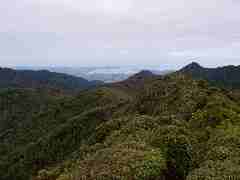
We managed to locate yesterday's pick up point along the Mangaokewa Rd, so it was on from there, reaching the end of the Mangaokewa Stream, then over the saddle into the (upper) Waipa Valley - following the river via roads for a while (pic of falls), through a farm, then the theory was via some short stretches of forestry roads.

Milled within the last year or two, the forest road finished in the usual mess of an old skid site, with the continuation for a while having been destroyed completely by the logging. Not what I had expected, so the brambles that I had to work my way through at times had a good go at my unprotected legs. Tried boulder hopping along the Waipa River (river small, boulders large) as an alternative. Eventually met up with the much roughened forest road after one very slow rough km, and then made my way, including a ford of the Waipa River down to the main road. And then from there to the corner of Link Rd and Barryville Rd in the Pureora Forest Park.

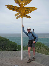
From there a drive through the forest for around 10 km to the geographic centre of the North Island - so a fair way from Cape Reinga. I am having a break now while I prepare for the next sections of Te Araroa.

Sunday, April 11, 2010

Mangaokewa River Track and onwards


25.6 km - 7.2 hours

A chilly autumn start in the steep sided Mangaokewa Valley that soon warmed up with the sunny day. This track leaves from a camp site and heads upstream for 16 km - bush reserves, farm land, various forest types, all the while following a super stream. (pic) Given its cachment area though, it must have some wild times after a lot of rain.

The track follows the stream closely most of the way, although climbing over bluffs now and then, finding a few swampy patches, and not completely free of brambles and gorse - but generally that is under control. At one point a couple of goats sprang up and ran away very close to me. And then some huge red mushrooms in the last patch of forest before hitting the final farm paddocks.

From the road end I continued up to the corner with Mangaokewa Rd, and then kept on there for another 6 km steadily climbing up the hill still following the stream that is getting smaller, but still rushes along. More goats running away from the road.

Te Kuiti Walk


Saturday April 10th - 6 km - 1.2 hours

This walk was done in two sections in between being in Te Kuiti on the day of the annual Great Muster - when a mob of somewhere between 1000 and 4000 sheep is run down the main street of the town (pic). This is the fun side of the national sheep shearing championships which have been happening here for the last few days.

Anyway, a very pleasant stream walk around the back streets of Te Kuiti - we normally just drive through the town with only a short stop. Some road walking for a short distance,
then back onto walking alongside the Mangaokewa stream which provided a taste of what I will be doing for tomorrow's walk. Brambles about, but avoided them for now. End of the Te Araroa
walk for today.

Then a quick road walk under the Waiteti railway viaduct and back to Te Kuiti just in time for the Great Muster.

Monday, April 5, 2010

Waitomo to Te Kuiti

13 km - 5.25 hours

This track alternates between open farmland and patches of bush - and as promised a few significant up and down sections that were fairly steep. Reasonably slow going, but being careful I did not deviate from the marked route too much after the first valley. The second patch of bush provided a pleasant walk along a ridge, then wound via a farm track down to another valley.

Across that, and then a cute wee suspension bridge (pic) across the Mangapu River - a muddy stream with steep sides - then into the Pehitawa Forest on a very tidy track. Then out onto farmland for what was supposed to be an open walk to the top of Brook Park in Te Kuiti.

But half way between Oparure Rd and Gadsby Rd the markers vanished (meaning I searched up and down the next fenceline for them, but did not find them or the expected stile. Continued on in the right direction, but the other side of Gadsby Rd was the same, so headed down there to the main road, right on the outskirts of the town anyway. Looking forward to having a walk up and down Brook Park next time I am back.

Mahoe Forest to Waitomo

Sunday 4th April - 25 km (and some) - 10.5 hours

An early start took me through farmland, then on an old track through the forest from Honikiwi Rd to Mahoe Rd. Shoulder high ferns to brush past - fine except for where a farm bike had been through and coated them with (now) dried mud. Farm land, a minor road, and then into forest again at the Oamaru Reserve.

This is a new track (because of access issues for the first half of the old one), well marked, but fairly slow going as it was a bit uneven, but made steady progress up and down through the forest, then down and up a long fenceline into a valley - then up and down again, and up some more - and the sun had come out too, so quite hot. On the next up section the track initially pointed through what looked like thick scrub, but the alternative I tried was worse, so after a rough hill climb, I rejoined the real track.

This then dived off into trees, with pleasant walking, and at some point changing from the new track into the original track which looked to be on an old forest road. At this point the markers became a lot less frequent, leading to a wrong turning, before back tracking and being more vigilant the second time. This wound its way down through the forest to follow a stream. My track map had a side turning marked part way along, so followed one when I found it, but that was wrong - so back tracked again.

And then there was a wide shallow river to cross (shallow thanks to dry weather - you don't go this way after heavy rain) - my feet really appreciating cooling down at this point. The real track actually follows the forest road up and down all the way down to near Waitomo - pleasant enough, but at this point I was quite tired.

The last section was to take a short track down the hill to join the Waitomo Walkway, but as warned by the neighbour, the brambles were out in force, and although my walking pole could deal to some of them, it was time to give up on them and head down the road to Waitomo village.

My hardest and longest day of Te Araroa so far - quite long sections of rougher track, and my track maps having some significant variations from where the new and original track actually went - errors of navigation really cost time and energy. Great country though - forest, hills, views, streams - I love it (pic).

Mt Pirongia Traverse, and on to Honikiwi Road

Saturday 3rd April - 33 km - 8.8 hours

Not yet used to the reduced daylight hours, we had a mostly dark drive to the north end of the Mt Pirongia track. Daylight arrived soon after, as I headed off alongside a stream, then into the bush for a steady climb for a while on a good track, getting rougher as I neared the top. Lovely views from the first 950m peak, then on to Mt Pirongia (959m) and its high viewing platform for an early lunch with views in all directions - some high cloud only.

Then on to check out the Pahautea Hut, before turning off down the revised Hihikiwi track. To the Hihikiwi lookout it is on the most amazing boardwalk, which at times is quite high above the forest floor - a bit disconcerting at first - not a place to be distracted and put a foot wrong ! This has been installed recently, and dedicated to Noel Sandford who has played a huge part in getting Te Araroa to where it is today.

After the lookout the track became more standard, working its way onto a ridge heading in the right direction, then following that up and down until finally reaching the southern edge of the Pirongia Forest Park. Finally found some of the famous Pirongia mud on the way - and it hasn't been raining much lately either.

Arrived at the track exit in very good time (5.5 hours), so then went on to the next section of Te Araroa - the Pirongia South Walk - going down mostly very minor country roads with some good views, including a walk on a road through the Te Rauamoa Reserve to finish the day.

West of Hamilton to foot of Mt Pirongia

Friday 2nd April - 27.5 km - 5.75 hours

Met up with the chooks again at Taitua Arboretum, on a cooler morning, heading westward via quiet country roads with frequent views in all directions.

These took me to the Raglan road, through Whatawhata, across the Waipa River, then picked up the Waipa River Walk. Some pleasant walking alongside the river, and a new found skill for when brambles grab my legs - Freeze ! Not many of those, but then two paddocks of boisterous young cattle - the sort that like to run up behind you when you are not looking and have to be shooed away before they bowl you over.

And so around the tiver some more, and some more quiet country roads to the start of the Kapamahunga Walkway - a walk along farm tracks through hilly limestone country with great views and cattle that were just happy to run away. Just loving the Waikato hills (pic).

A patch of pleasant bush, then some more quiet country roads to the start of tomorrow's Mt Pirongia jaunt.