Sunday 24th April 38.5 km 8 hours, including a good break in The Mussel Pot, Havelock, for lunch
Rained all night, and pleased that my tent coped remarkably well. Packed up in the rain, and then off on the last 30 minutes of the Queen Charlotte Track to Anakiwa. Water everywhere, and the rain continuing on through the day only too regularly. So now at the head of Queen Charlotte Sound, with a combination of walking tracks and roads to take me away west from the sound, and over to the head of an arm of Pelorus Sound.
As promised the side track up Mahakipawa Hill was steep, but fortunately not the bare clay surface going up as per the TA notes - if it had been, that would have meant a road diversion. But steep up, and then steep and more slippery down with Havelock being so close at the bottom, so a lot of care needed to stay on my feet - success !
Patchy views of the surrounding hills, and the Sounds looking quite brown from the runoff from all the rivers and creeks that were now in flood. After lunch along SH6 towards Canvastown, with time to watch the flooded rivers and creeks, and the many waterfalls on the side of the road. With the creeks flooded, at Daltons Bridge, rather than taking the new track from there to Pelorus Bridge (which has side creeks to cross) I stayed on the main road. As soon as I reached the Pelorus Bridge DOC sign a sandfly spotted me.
A change into dry clothes (yay!), a pie at the cafe, and time now to leave Te Araroa until next summer. Richmond Ranges ahead, which are serious tramping country - I will have to check out my options before continuing on.
Monday, April 25, 2011
Queen Charlotte Track Day 2
Saturday 23rd April 7.5 hrs 32.5 km
Bay Of Many Coves campsite to Umungata (Davies) Bay campsite. Now along the ridge between Queen Charlotte and Kerepuru Sounds, with views sometimes to one side, and sometimes to the other. Fortunately not following the exact contours of the ridge, so not a steep up and down track all the time - just some of the time when coming to the lower saddles between the two Sounds.
By late morning the occasional light drizzle had become occasional, and then more persistent rain. But not cold or windy, so relatively pleasant if you kept moving. Track becoming a bit more slippery in places, but staying on my feet all of today. Pitched tent in the rain, and it now really was quite continuous. Just about at the end of the track, but stopped here because this is the last DOC campsite.
South Island - Queen Charlotte Track
Easter Friday 22nd April 36 km 7 hours
From Ship Cove to Bay of Many Coves campsite. A fine day with some cloud, but wet weather on the way, so making the most of it today.
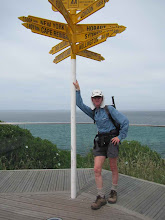
Time for a quick look at the Cook memorial, then off up the hill away from Ship Cove. In and out of little valleys, past Resolution Bay then up to a saddle looking down into Endeavour Inlet. Where I caught up with the large group of mountain bikers who had passed me earlier. But then they were gone off down the hill.
A close encounter with the track, courtesy of a tree root, left a bit o damage, but nothing to hold me up too long. Down along the shore of Endeavour Inlet, on past the houses at the end, and then a lunch stop looking back to where I had been an hour or so earlier. And so the track winds on, into and out of Big Bay, and then the direct route up to Kerepuru Saddle (bypassing Camp Bay) Now views of Sounds on both sides of the track, notably from the 2 Eastwell lookouts - the second especially a superb high point up a steep side track.
And so on to the Bay of Many Coves campsite on the ridge looking down into Queen Charlotte Sound. A weka tried to souvenir one of my walking socks, but had the sense to understand that it was fairly undesirable, leaving it a short way off in the undergrowth.
From Ship Cove to Bay of Many Coves campsite. A fine day with some cloud, but wet weather on the way, so making the most of it today.
Time for a quick look at the Cook memorial, then off up the hill away from Ship Cove. In and out of little valleys, past Resolution Bay then up to a saddle looking down into Endeavour Inlet. Where I caught up with the large group of mountain bikers who had passed me earlier. But then they were gone off down the hill.
A close encounter with the track, courtesy of a tree root, left a bit o damage, but nothing to hold me up too long. Down along the shore of Endeavour Inlet, on past the houses at the end, and then a lunch stop looking back to where I had been an hour or so earlier. And so the track winds on, into and out of Big Bay, and then the direct route up to Kerepuru Saddle (bypassing Camp Bay) Now views of Sounds on both sides of the track, notably from the 2 Eastwell lookouts - the second especially a superb high point up a steep side track.
And so on to the Bay of Many Coves campsite on the ridge looking down into Queen Charlotte Sound. A weka tried to souvenir one of my walking socks, but had the sense to understand that it was fairly undesirable, leaving it a short way off in the undergrowth.
Subscribe to:
Posts (Atom)